29-N general election in Málaga How to vote, the calendar and every result since 1977

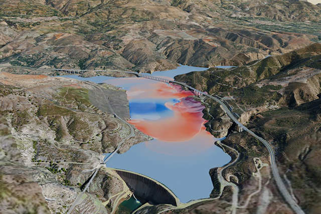
The UMA simulates the wave that a landslide in the Rules reservoir would cause in the event of an earthquake

Topics Agencia de Emergencias de Andalucía Universidad de Málaga

The EDANYA group took part in RespuestA26, the Junta's drill in Granada: the wave would reach the A-44 in less than half a minute.
·

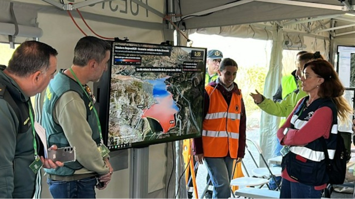
Varias personas con chalecos de emergencia observan una pantalla con un mapa de embalse y zonas inundadas bajo una carpa.
Photo: Universidad de Málaga · Sala de prensa
Researchers from the University of Málaga have taken part in «RespuestA26», the earthquake drill that the Andalusian Emergency Agency held on Tuesday, November 10 in the province of Granada, with about 200 personnel from different organisations. The exercise was based on two fictitious earthquakes with epicentre in Santa Fe, of magnitude 4.2 at 9:00 and of magnitude 6 at 10:00, and took place in Santa Fe, Atarfe and the Rules reservoir, in Vélez de Benaudalla. In this last scenario the second earthquake would trigger the El Arrecife landslide, on the western slope of the reservoir. The EDANYA group, from the Department of Applied Mathematics of the UMA, was in charge of simulating that landslide with its Landslide-HySEA model. According to its calculations, about 8 million cubic metres of material would enter the full reservoir at almost 30 metres per second and would generate a wave of 46 metres above the water level on the opposite slope about 38 seconds later. The water would reach the A-44 in less than half a minute and the wave would overtop the dam a little more than a minute later. For the drill they prepared a 3D video, maps with wave heights, speeds and arrival times and an analysis of the water at the bridges in the area, for the teams at the command post next to the dam.

Where the scenario comes from

The case comes from a study published this year in the journal Landslides, led by the Instituto Andaluz de Ciencias de la Tierra of the University of Granada, with researchers from seven universities and centres in Spain and Italy. It concludes that the complete detachment would require an earthquake of magnitude 6 to 6.6 on some nearby fault and a very wet period. The UMA team ran more than 5,000 simulations to narrow down the uncertainty. The researchers José Manuel González Vida and Sergio Ortega stress that having these maps before an emergency allows geologists, infrastructure managers and emergency services to work together from the start.

Shall we let you know what matters?

Phone alerts

Change or remove it in my alerts

1 foto

Foto: Universidad de Málaga · Sala de prensa